01
Read the map fast
See radar-derived hail formation, live NOAA reports, and the part of the storm that deserves the next zoom.
Limited Offer
START YOUR 5 DAY FREE TRIAL NOW
Start monthly checkout, add your card, cancel before day five if you do not want to be billed.
HAIL DRIVE
Hail Drive helps storm-focused teams back the right streets, check the right roofs, and walk into the next conversation with proof in hand. Read radar-derived hail swaths, live NOAA reports, wind and tornado cores, and property-level history in one workflow built for the hours that matter most.
Workflow
Radar swaths show where hail likely formed. Live NOAA reports show where the storm was actually seen on the ground.
Workflow
Search the address or drop a pin so your team can stop guessing and decide whether the stop is worth the drive.
Workflow
Turn the storm into a clear report that helps people feel the urgency without drowning them in weather talk.
Why Hail Drive
Hail Drive is built for the teams that cannot afford to back the wrong street, miss the wind story, or walk into the first conversation sounding uncertain.
01
See radar-derived hail formation, live NOAA reports, and the part of the storm that deserves the next zoom.
02
Pull the address, check the nearby storm story, and decide if the stop is worth your next hour.
03
Turn the storm into a clearer report so the conversation starts with proof instead of doubt.

Built To Move
The homepage should send people three places: hail maps for the broad footprint, hail reports for cleaner storm context, and pricing when they are ready for the full Hail Drive app.
Start wide. See the footprint, the swaths, and the report-backed pockets that deserve attention first.
Open MapTighten the story with dates, places, and reported activity before you narrow into one property.
Open ReportsWhen you are ready for the full Hail Drive app, this is where the faster workflow, deeper layers, and field-ready reports start.
View PricingProduct View
Hail Drive helps your team read the storm faster, back the right property, catch wind and tornado context other people miss, and walk into the next conversation sounding like the one who actually knows what happened.

Why Teams Pay
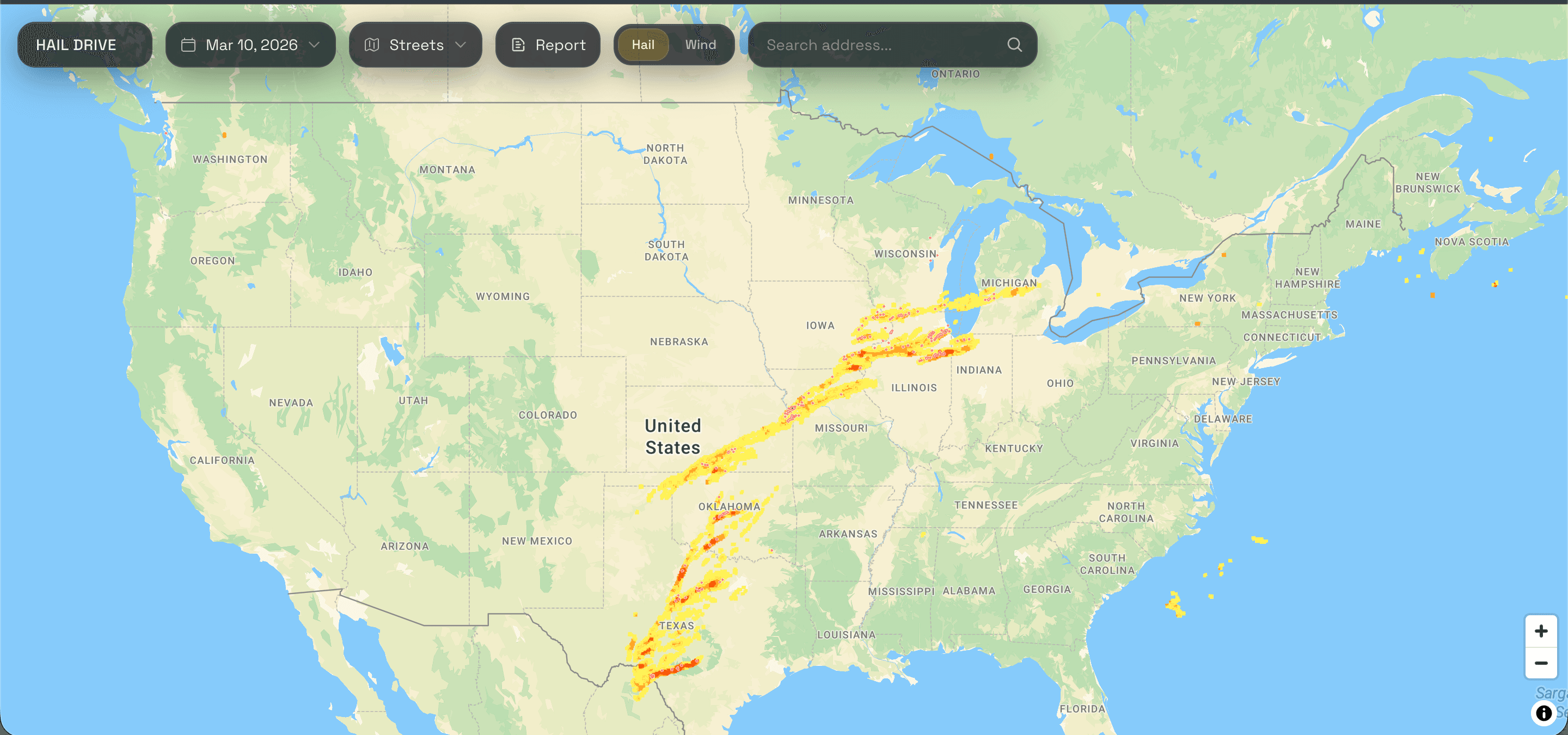
A recent hail map should do more than throw color across a county. Hail Drive helps roofers, storm reps, and adjusters see where the storm got serious, where live reports give it weight, and where the next stop has a better chance of being worth the drive.
Legend
The swaths are radar-derived hail formation. The cores show where the signal tightens up or where someone actually reported it on the ground. That difference matters when you decide where to go first.
What It Means
The outer edge of the radar story. It usually means hail under 1 inch likely formed somewhere in this zone.
The stronger middle band. It usually means around 1-inch hail likely formed here and the day starts looking more serious.
The hottest hail band on the map. It points to radar-derived 2+ inch hail formation and raises the stakes fast.
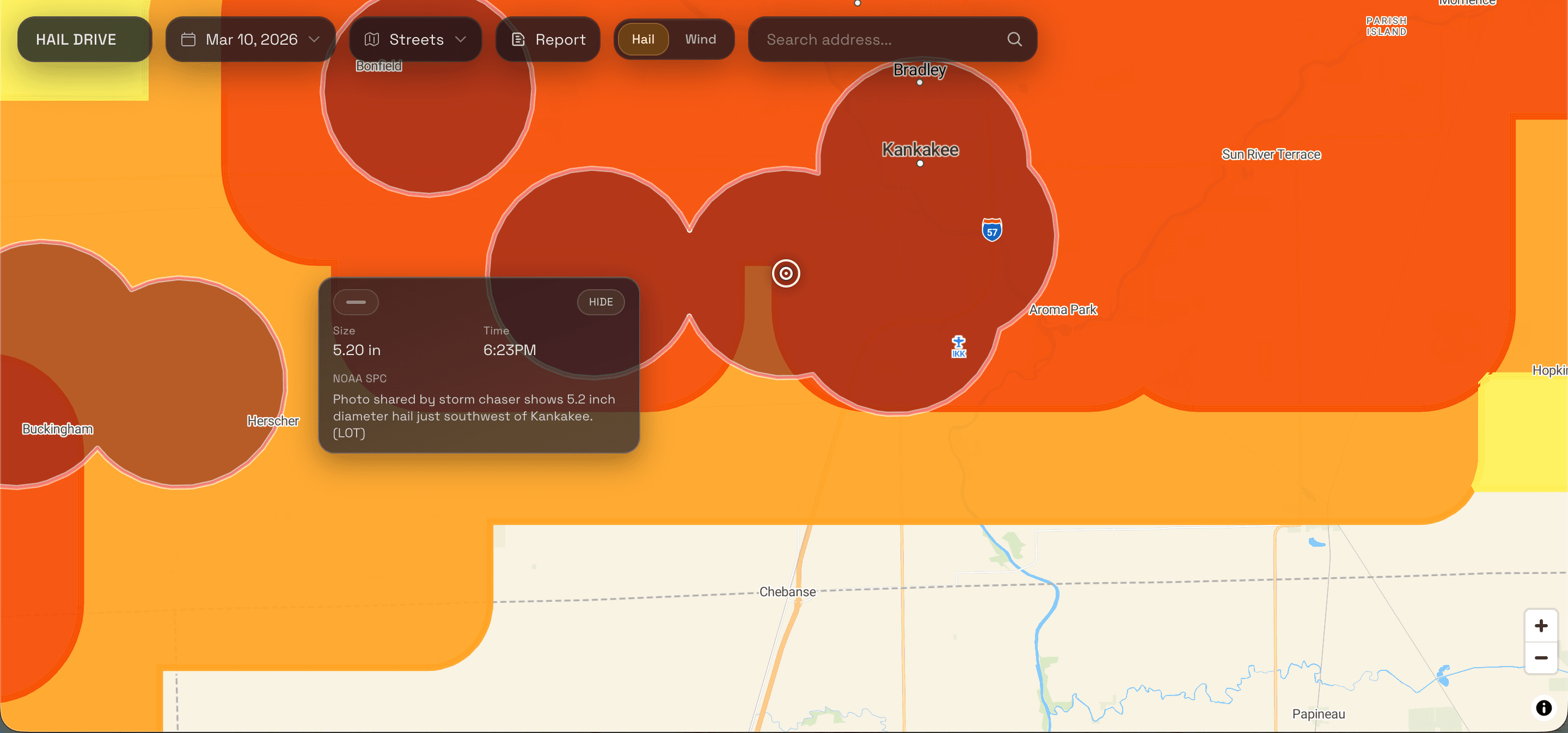
This is the human proof on the ground. Someone actually reported hail here, which helps the nearby streets feel more trustworthy.

Address Intelligence
Pull the address, standardize it, drop the pin, and make sure the stop deserves your time before wheels ever roll.
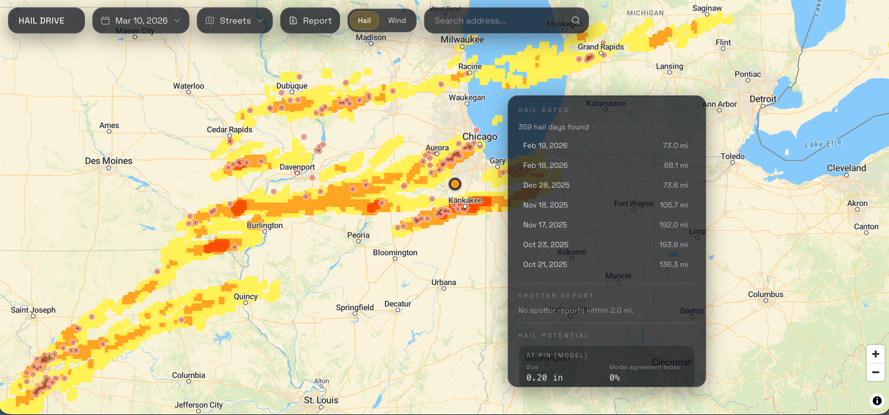
Property History
Hail dates, nearby reports, and history around the address help your team walk up with a sharper read on what may already be sitting on that property.
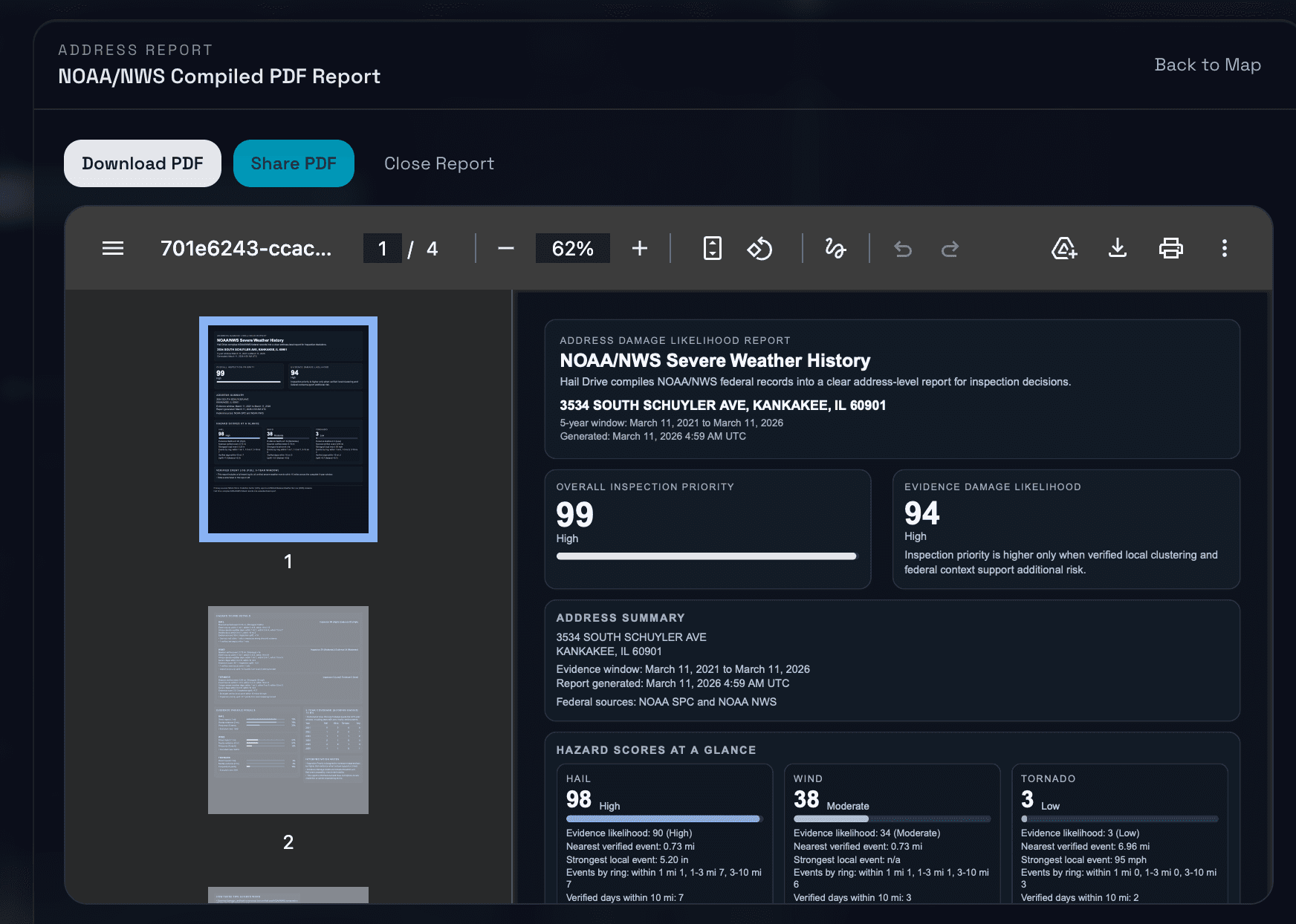
Report Proof
Pull hail, wind, tornado, verified events, and coverage into one clean report that feels credible in the driveway, in the office, and anywhere someone needs a reason to take the storm seriously.
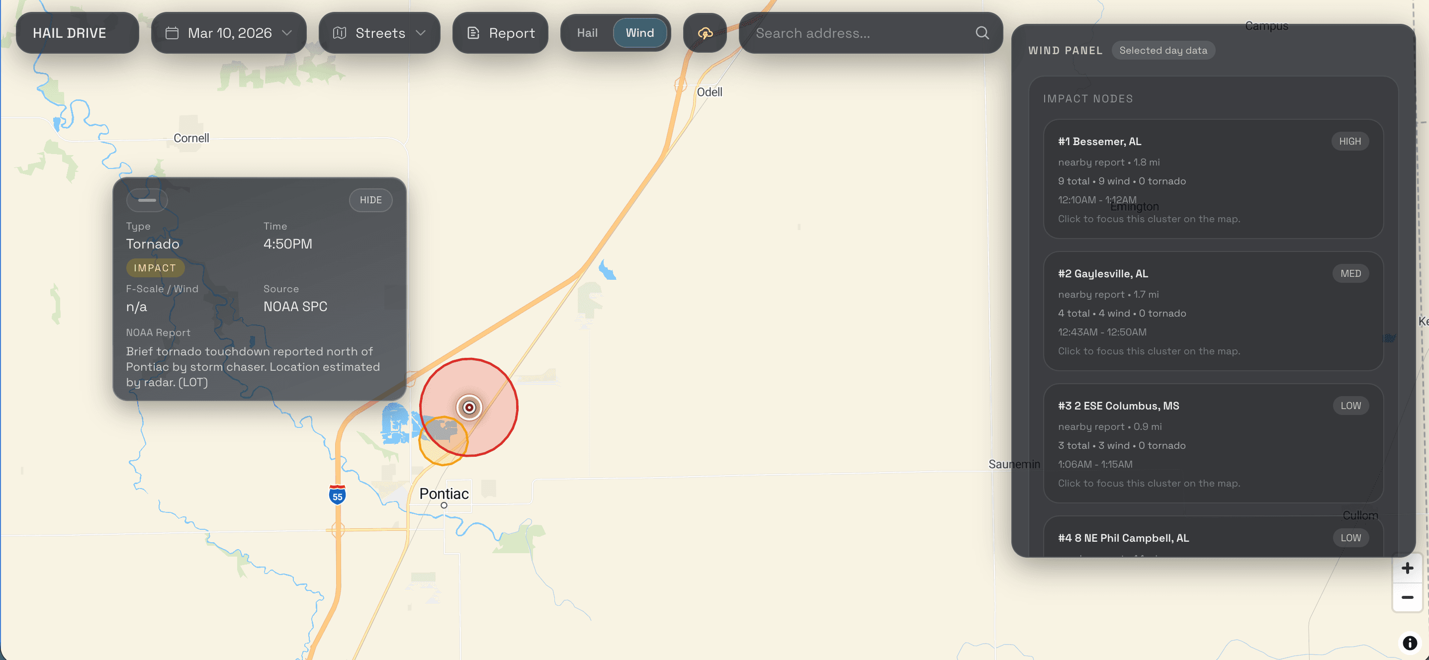
Tornado + Impact
Tornado and impact cores change the tone of the day fast. They help a team feel where urgency just got heavier.
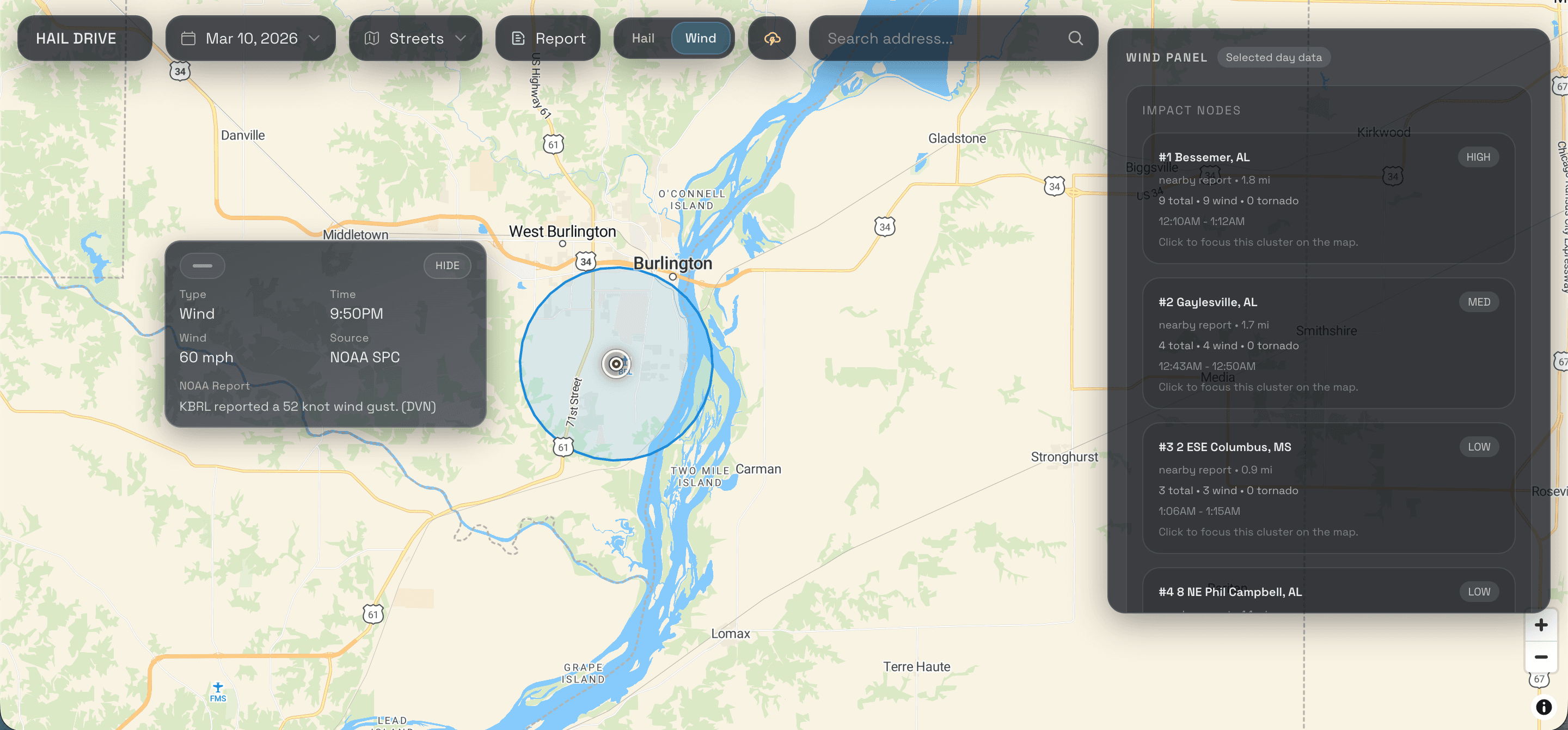
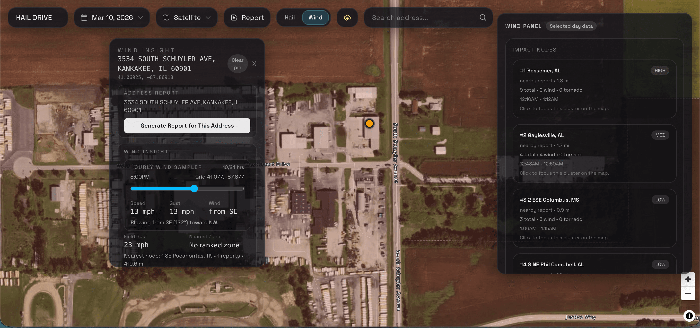
Wind
Wind mode catches the streets that do not look obvious on hail alone, then gives speed, gust, and direction context for the stop.
Wind Detail
Once a street matters, wind detail helps your team read gust speed, direction, and nearby context without switching tools.
Yellow is the wider radar-derived edge, orange is stronger hail formation, dark orange is the hottest hail band, and the NOAA live report core is the real-world proof from the ground.
No. A swath shows where hail likely formed in the radar story. It helps narrow the field, but it does not guarantee meaningful impact at that exact roof or address.
They tell you the day may be heavier than a simple hail event. Those cores help crews, reps, and adjusters see when the conversation needs more urgency and better preparation.
Yes. The paid workflow lets you pull the address, review the nearby storm story, and decide whether the stop deserves your time now.
Yes. Hail Drive turns the storm into a clean report that feels calmer, clearer, and more credible than trying to explain the day from memory.
You get the actual Hail Drive app: faster map decisions, property-level workflows, wind and tornado context, and reports built to carry real weight in the field.
Ready To Go Deeper
This is for the moments when the right street matters, the right evidence matters, and the right app can make the whole day feel different.